|
|

 |
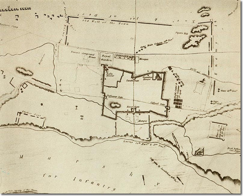
| This map is part of an album of drawings and sketches of Afghanistan entitled 'The Defence of Jellalabad dedicated to Her majesty by the late Major-General Sir Robert Sale'. It was published around 1846 a year after Sale had been killed at the battle of Moodkee. There is no compass but north is at the base of the map where the bank of the Kabul river can just be seen near the bottom left corner. The River Gate is in the middle of the north wall, with the Kabul Gate on the west side and the Peshawar Gate on the east side. The town had shrunk as can be seen by the old wall towards the top of the map, with Piper's Hill contained in the upper right corner. The scale of the map is not indicated but the length of the north and south walls was a little over 500 yards. |
First Afghan War | Siege of Jellalabad
Armed Forces | Art and Culture | Articles | Biographies | Colonies | Discussion | Glossary | Home | Library | Links | Map Room | Sources and Media | Science and Technology | Search | Student Zone | Timelines | TV & Film | Wargames
