|
|

|
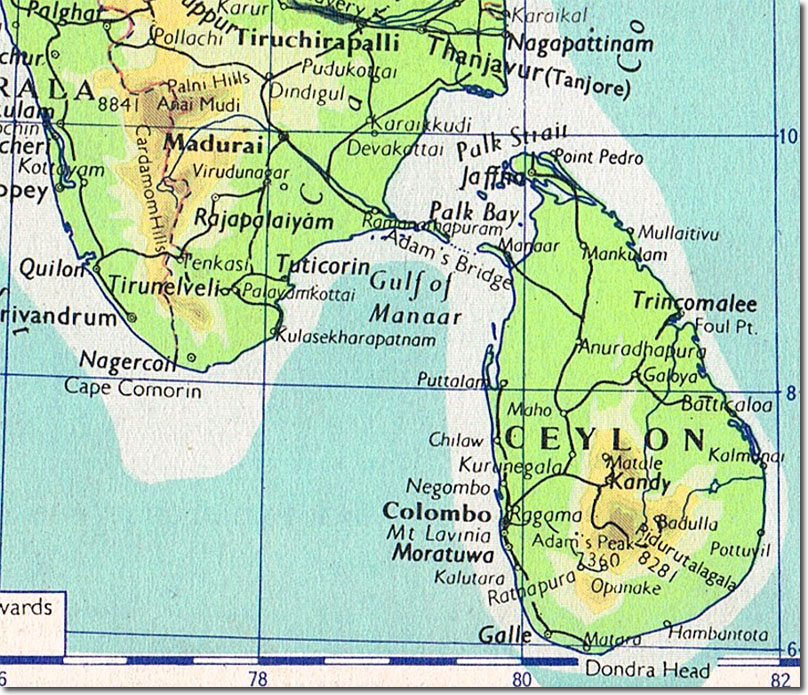
| This map is taken from a school atlas of 1960. Ceylon became Sri Lanka in 1972. The town of Columbo is on the west coast of the country, Kandy can be seen in the central highlands. Trincomalee is on the east coast. In 1804 another attempt at invading the central area of Celyon was made, starting from several points, one of which, commanded by Captain Johnson of the 19th, was Batticoloa on the east coast. |
Armed Forces | Art and Culture | Articles | Biographies | Colonies | Discussion | Glossary | Home | Library | Links | Map Room | Sources and Media | Science and Technology | Search | Student Zone | Timelines | TV & Film | Wargames
