|
|


|
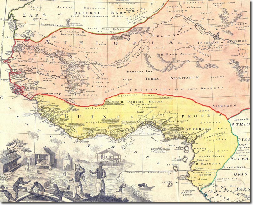
| This 1743 map of West Africa purports to illustrate the source of slaves from West Africa. It still shows the Niger as heading out to the East towards the Nile. It still shows the area in a pre-colonial state - only showing the forts and trading ports of the English, Dutch and Danish. It also pulls the purported kingdom of Ethiopia far further West than justified. |
Armed Forces | Art and Culture | Articles | Biographies | Colonies | Discussion | Glossary | Home | Library | Links | Map Room | Sources and Media | Science and Technology | Search | Student Zone | Timelines | TV & Film | Wargames