|
|


|
|
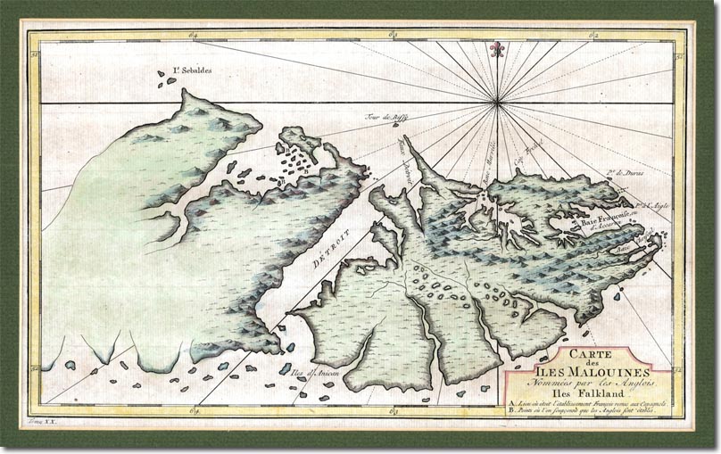
This is an interesting maps which is worth comparing to the British 1773 map. This map clearly shows that the French had only a hazy idea of the coastline of the entire archipelago and particularly limited knowledge of the western island. The map was drawn by the French cartographer Etienne Andre Philippe de Pretot in the late 1760s, and first appeared in the 1771 edition of the explorer Louis-Antoine de Bougainville's book Voyages. The heading says in old French: "Carte des Iles Malouines, Nommees par les Anglois Iles Falkland," or "Map of the Malouines Islands which the English call the Falkland Islands."
The French had called the islands 'Isles Malouines' since the 1720s. In the early 18th century, French explorers had encountered the islands on their way around Cape Horn to the Pacific. Many of them had set sail from the French port of St Malo, hence the name, which first appeared in the 1720s on maps drawn by the French royal cartographer Guillaume Delisle. The Spanish and Argentine name for the islands; 'Malvinas' is a corruption of this French name. The name of Sebaldes has been relegated to a small collection of islands off the north-west coast. The A on the map marks the French settlement of Port Louis. The three B's on the map where the French believed the British settlement to be located. Port Egmont was actually even further to the west. The Falkland's Channel has been given the French name for strait: de troit. |
Falkland Islands | Falkland Island Maps
Armed Forces | Art and Culture | Articles | Biographies | Colonies | Discussion | Glossary | Home | Library | Links | Map Room | Sources and Media | Science and Technology | Search | Student Zone | Timelines | TV & Film | Wargames