|
|


|
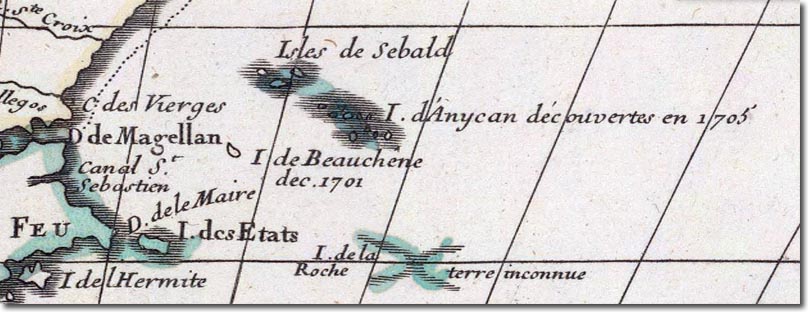
| This is an early 18th Century French map published by Guillaume de Lille in 1705. It uses the name of the Sebald Isles for the Western part of the archipelago and the name Isle d'Anycan for the Eastern isles. It is quite clear that the author only has the haziest idea of the location and shape of the islands. He is merely aware that they exist and that there appear to be a number of small islands, he does not have the two significant Eastern or Western Islands marked at all. The Isle de Beauchene is significantly further away from the Falklands than it actually is. He does know that they exist, but this seems to have been freshly conveyed to him as it claims the Eastern part was only discovered in 1705, the year of the publication of this map. |
Falkland Islands | Falkland Island Maps
Armed Forces | Art and Culture | Articles | Biographies | Colonies | Discussion | Glossary | Home | Library | Links | Map Room | Sources and Media | Science and Technology | Search | Student Zone | Timelines | TV & Film | Wargames