|
|


|
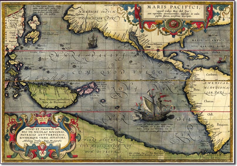
| This is one of the earliest maps of the Pacific region and it clearly shows the idea that Spice Islands and New Guinea were assumed to be large as they were the source of so much wealth and profitable products. Much of the information was taken from Portuguese and Spanish mariners who had successfully been able to establish trading links and proto-empires in the region. The map also marks a solid landmass to the south. The route through the Magellan Straits convinced some scholars that there was another landmass to the South and they had no idea how far this extended. This map assumes that circumnavigated the world itself and was therefore linked. |
Armed Forces | Art and Culture | Articles | Biographies | Colonies | Discussion | Glossary | Home | Library | Links | Map Room | Sources and Media | Science and Technology | Search | Student Zone | Timelines | TV & Film | Wargames