|
|

 |
|
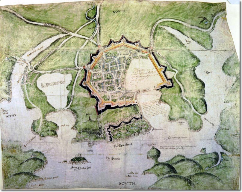
It is not clear when this map was drawn but it may well be a map by rival engineers in the aftermath of the Spanish Armada in 1588 when it was realised that Plymouth had only narrowly avoided being attacked and sacked and that a radical updating of the defences were required. Drake as Mayor did actually build a new fort where the modern day Citadel is located but there were still concerns that these were not adequate enough against a determined enemy. One such engineer submitting proposals was the Spanish engineer Federigo Giambelli. He was employed by the Crown between 1585 and 1602. In that last year of 1602 at the request of the Privy Council, Giambelli surveyed Drake's fort and the town itself. Giambelli made three reports on Plymouth. He suggested surrounding the town with a wall with nine ravelins and increasing the extent of the fort so that it would approach the footprint of the later Citadel. With the arrival of King James in 1603 it was hoped that England could avoid such a costly outlay of defences by using diplomacy and hoping to draw closer to Elizabeth's old antagonist of Spain. This meant that the plans were quietly shelved until the Civil War and its aftermath saw yet another reevaluation of Plymouth's defences which resulted in the building of the Citadel.
Stonehouse is shown as a tiny settlement off to the west. Millbay marshes seem to extend quite far and help in isolating the two settlements from one another. |
Empire in Your Backyard: Plymouth Article
Armed Forces | Art and Culture | Articles | Biographies | Colonies | Discussion | Glossary | Home | Library | Links | Map Room | Sources and Media | Science and Technology | Search | Student Zone | Timelines | TV & Film | Wargames