|
|


|
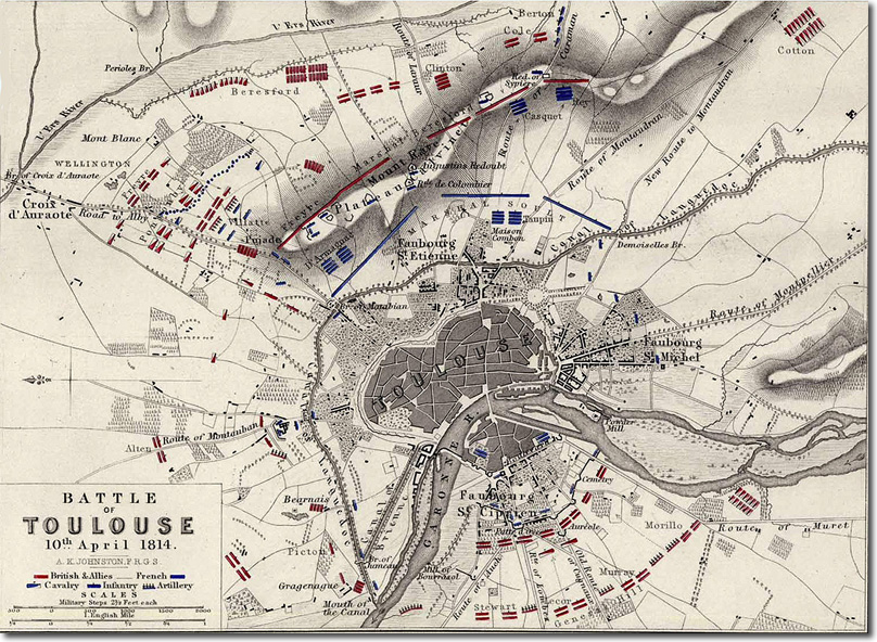
| This 19th century map of the battle of Toulouse shows the positions of Wellington' Allied army, encircling the city and its defences. North is on the left of the picture so that the main attacks come from the east and west. The Black Watch were in Clinton's division whose name can be seen towards the middle of the top edge between Beresford and Cole. The positions of the French redoubts is not clear from this map but it shows the Plateau Calvinet. The Jumeau canal bridge where Picton was supposed to make a feint attack is nowhere to be seen. |
Armed Forces | Art and Culture | Articles | Biographies | Colonies | Discussion | Glossary | Home | Library | Links | Map Room | Sources and Media | Science and Technology | Search | Student Zone | Timelines | TV & Film | Wargames