|
|


|
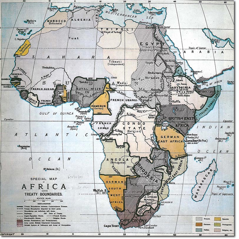
| This map shows Africa in 1891 when it was largely divided among the European powers. It contained many semi-official British "spheres of influence," like the Sudan, and company-administered areas, like the rich but uncolonized highlands of East Africa. This area round the source of the Nile was a particular temptation to imperial rivals, and the smouldering tensions nearly came to a head at Fashoda in a bitter Anglo-French clash. |
Armed Forces | Art and Culture | Articles | Biographies | Colonies | Discussion | Glossary | Home | Library | Links | Map Room | Sources and Media | Science and Technology | Search | Student Zone | Timelines | TV & Film | Wargames