|
|


|
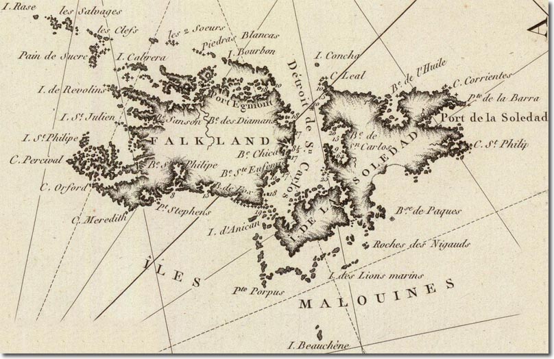
| This is a French naval map from the year 1800 during the Napoleonic Wars. It is an interesting mix of English, French and Spanish names. Port Louis is now renamed as the Spanish Puerto de la Soledad although the English port of Egmont is still marked on the map despite its being abandoned earlier. Interestingly, it seems to allocate the name Falkland to the western isle and gives the name Ile de la Soledad to the eastern one. The French name of Iles de Malouines is still being used for the entire archipelago. |
Falkland Islands | Falkland Island Maps
Armed Forces | Art and Culture | Articles | Biographies | Colonies | Discussion | Glossary | Home | Library | Links | Map Room | Sources and Media | Science and Technology | Search | Student Zone | Timelines | TV & Film | Wargames