|
|


|
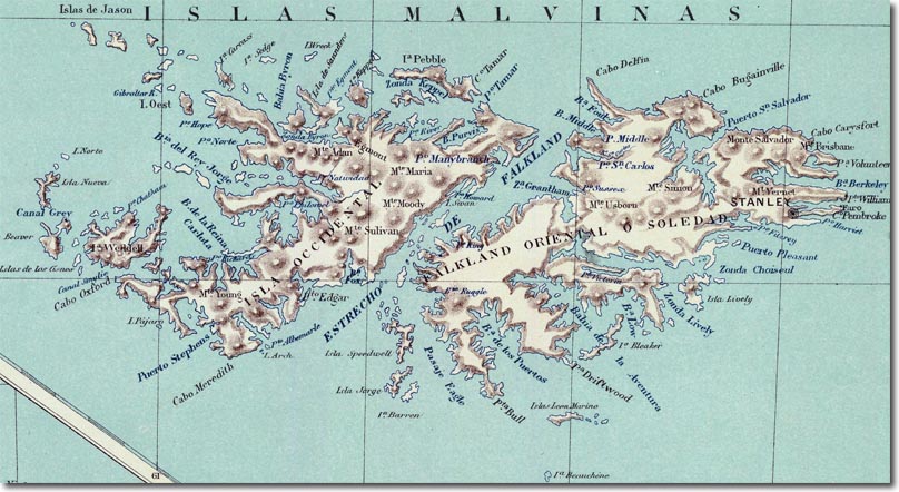
| This is an Argentine map published in 1888 by Felix Lajouane in Buenos Aires. It is interesting in a number of ways. First of all, it uses the hispanicised version of the French name for the islands; Malvinas. It does use a surprisingly large number of English names. The Sound is called the Estrecho de Falkland. The Eastern Isle is called; Falkland Oriental or Soledad (solitary) whereas the Western Isle is just called that - there is no mention of Falkland despite the earlier maps only using Falkland to refer to this Western Isle. This Argentine map marks Stanley as the prominent settlement. It uses mainly the English names although understandably with Spanish geographical terms. |
Falkland Islands | Falkland Island Maps
Armed Forces | Art and Culture | Articles | Biographies | Colonies | Discussion | Glossary | Home | Library | Links | Map Room | Sources and Media | Science and Technology | Search | Student Zone | Timelines | TV & Film | Wargames