|
|


|
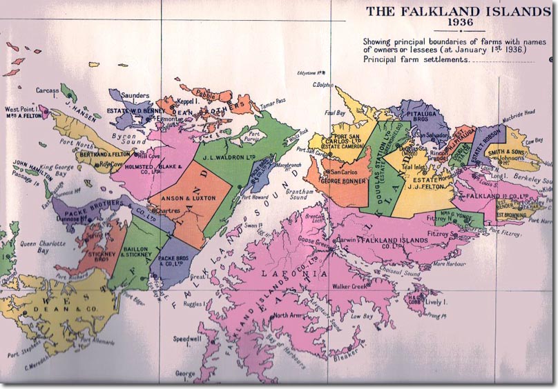
| This map illustrates just how much of the island was carved up by the Falkland Island Company and various absentee landlords. Many of the lands were leased to local Falkland Islanders but the owners were often commercial entities back in the UK. |
Falkland Islands | Falkland Island Maps
Armed Forces | Art and Culture | Articles | Biographies | Colonies | Discussion | Glossary | Home | Library | Links | Map Room | Sources and Media | Science and Technology | Search | Student Zone | Timelines | TV & Film | Wargames