|
|


|
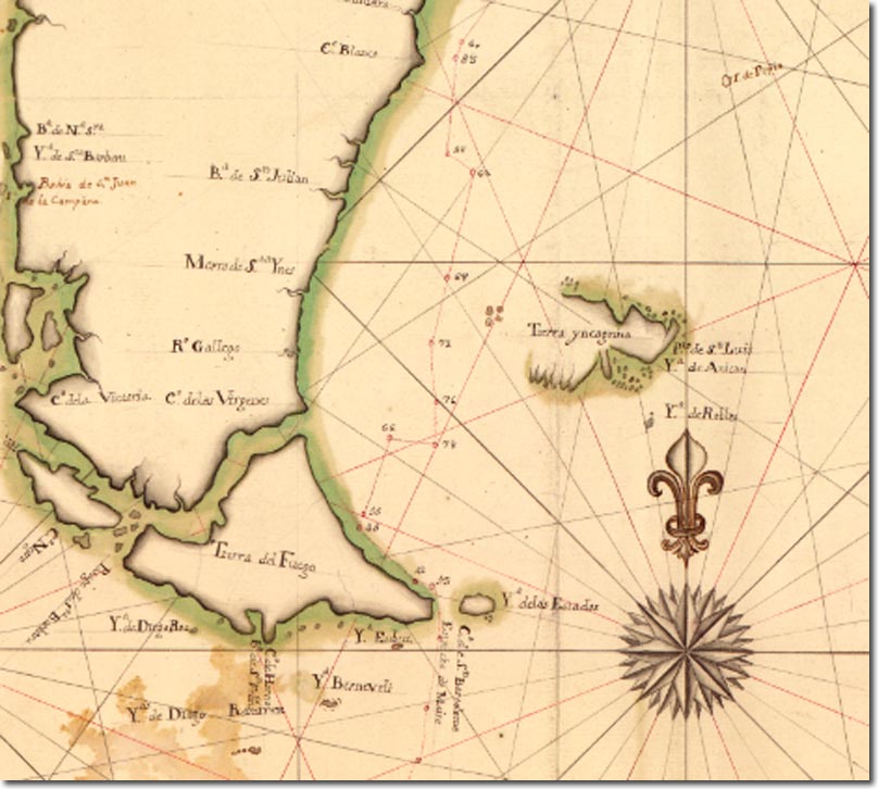
| This map shows just how little the Spanish knew about the islands of the Falklands. It is marked Terra Incognita and there is no attempt even to mark out the shape of the western islands. It must be from the 1760s as it shows the French settlement of St Louis marked on it. The islands are referred to as Ysla de Anican. The map is more concerned with the Cape Horn and Strait of Magellan. Indeed, it was the growing strategic importance of this area that made the Falklands into such a valued base for the British and French. |
Falkland Islands | Falkland Island Maps
Armed Forces | Art and Culture | Articles | Biographies | Colonies | Discussion | Glossary | Home | Library | Links | Map Room | Sources and Media | Science and Technology | Search | Student Zone | Timelines | TV & Film | Wargames