|
|

|
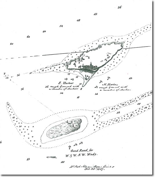
| This was a 1787 map that was used by the Royal Navy for the capture of the island in 1807. |
Heligoland | Heligoland Article
Armed Forces | Art and Culture | Articles | Biographies | Colonies | Discussion | Glossary | Home | Library | Links | Map Room | Sources and Media | Science and Technology | Search | Student Zone | Timelines | TV & Film | Wargames
