|
|


|
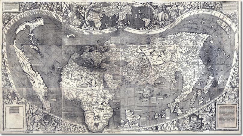
| This 1508 map shows a European view of the world. It was written in Latin and authored by Waldseemueller. There are a number of items of interest on this map. Clearly the prominence of an Asia that could be rounded at the Cape of Good Horn is obvious to see. The Portuguese had discovered and perfected this route. The spice islands of the Orient tend to be drawn far larger than they should have been. Possibly this is due to the fact that the author imagined that their size was somehow commensurate with the wealth that they seemed to generate for traders. In reality, the islands could be tiny. The thickness of the rivers in Russia and Asia is also of interest hinting that a navigable route from East to West might be found by exploring these waterways. The Americas are interesting. This is the first map that shows them to be distinct from Asia, although they had only been known about for 15 years before this map was drawn. There is a hint that North America is not joined with South America and many who had seen the two oceans from a vantage point in Panama were convinced they must be connected somewhere. A North West passage is suggested in this map, although interestingly, a South West passage is not! |
Armed Forces | Art and Culture | Articles | Biographies | Colonies | Discussion | Glossary | Home | Library | Links | Map Room | Sources and Media | Science and Technology | Search | Student Zone | Timelines | TV & Film | Wargames