|
|

|
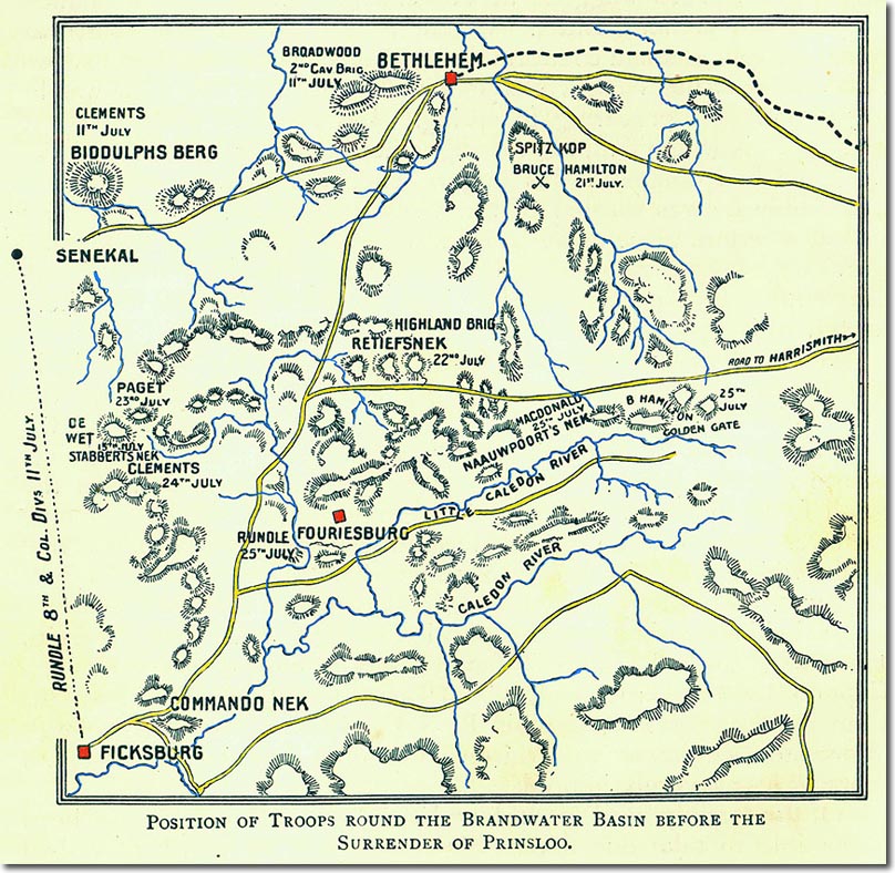
| This map, published in 1901 shows Slabbert's Nek on the left, but here called Stabbert's Nek. Bethlehem can be seen at the top and Fouriesburg near the middle. |
Armed Forces | Art and Culture | Articles | Biographies | Colonies | Discussion | Glossary | Home | Library | Links | Map Room | Sources and Media | Science and Technology | Search | Student Zone | Timelines | TV & Film | Wargames
