|
|

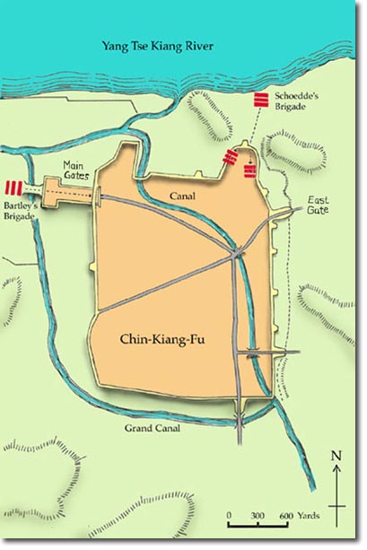 |
| The fortified town of Chin-Kiang-Fu, now called Zhenjiang, on the Yang Tse Kiang River, was built to protect Nanking. The high walls were made of packed clay revetted with brick and sometimes 40 feet thick at the base. The fortress was surrounded by suburbs which provided cover for the troops approaching the walls before the escalading began. Bartley's brigade can be seen before they crossed the bridge over the canal and forced their way through the outer gate. The Grand canal was a long waterway, the greater part of which was built by Emperors Wen and Yang-ti of the Sui Dynasty around 605 AD. It is 1,795 km, linking Beijing with Hangzhou which is south of Shanghai. |
Armed Forces | Art and Culture | Articles | Biographies | Colonies | Discussion | Glossary | Home | Library | Links | Map Room | Sources and Media | Science and Technology | Search | Student Zone | Timelines | TV & Film | Wargames
