|
|

 |
|
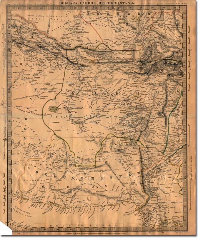
This 1838 Map shows much of the area that concerned British authorities in what was becoming known as the Great Game. The British were convinced that the Russians might extend their influence through Persia, to the Western Afghan Khanates and to Kabul itself. This would then put the Russians within strking distance according to the British.
If you look at this map carefully you can see that it is annotated to include information of a military nature, such as the distance required to travel for laden camels. The map was designed to show the feasibility of an invasion route and what distances and hurdles an invading army would have to overcome. |
Armed Forces | Art and Culture | Articles | Biographies | Colonies | Discussion | Glossary | Home | Library | Links | Map Room | Sources and Media | Science and Technology | Search | Student Zone | Timelines | TV & Film | Wargames
