|
|

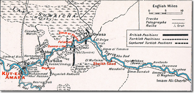 |
| The area of operations of the Tigris Corps in their attempt to relieve Kut is shown in this detail of a map published in 'The Great War' vol 7 published in 1916. Some names have been spelt differently to those in the text. Kut-El-Amara is on the left of the map at the confluence of the Tigris with the river Hai. East of that is Magasis (Maqasis in the text), the position of the Turkish pontoon bridge. Further east is Sanna-i-Yat (Sannaiyat), the main Turkish defence line. Then Felohieh (Fallahiya) to which the Turks withdrew from Umm el Henna (Hannah). And then Sheikh Saad the scene of B Squadron's heroic action in January 1916. |
Armed Forces | Art and Culture | Articles | Biographies | Colonies | Discussion | Glossary | Home | Library | Links | Map Room | Sources and Media | Science and Technology | Search | Student Zone | Timelines | TV & Film | Wargames
