|
|

|
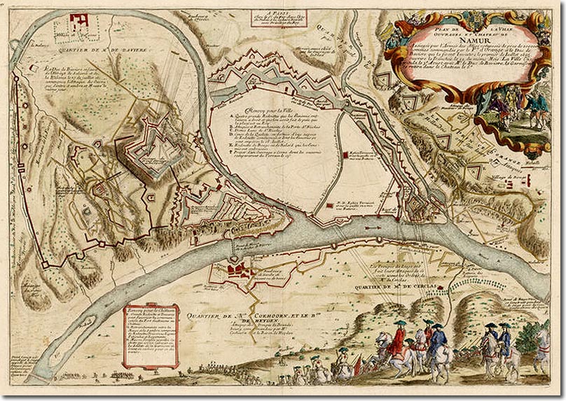
| This old map of the defences of Namur is contemporary to the time of the War of the League of Augsburg, also called the War of the Grand Alliance, also the Nine Years War. The citadel is on the hill near the fork of the rivers. The city was first besieged by the French in 1692 and taken from the Dutch. The defences had been built by Baron van Coehoorn, and after the French capture of the city these defences were further improved by the famous engineer Sebastien de Vauban. Louis XIV attended the first siege but the battle was commanded by the Duc de Luxembourg. When King William III and his allies beseiged the city they were finally successful when it surrendered on 1st Sept 1695. The defender Marshal de Boufflers lost 8,000 men out of a garrison of 13,000. The Allies lost 12,000. |
Armed Forces | Art and Culture | Articles | Biographies | Colonies | Discussion | Glossary | Home | Library | Links | Map Room | Sources and Media | Science and Technology | Search | Student Zone | Timelines | TV & Film | Wargames
