|
|

|
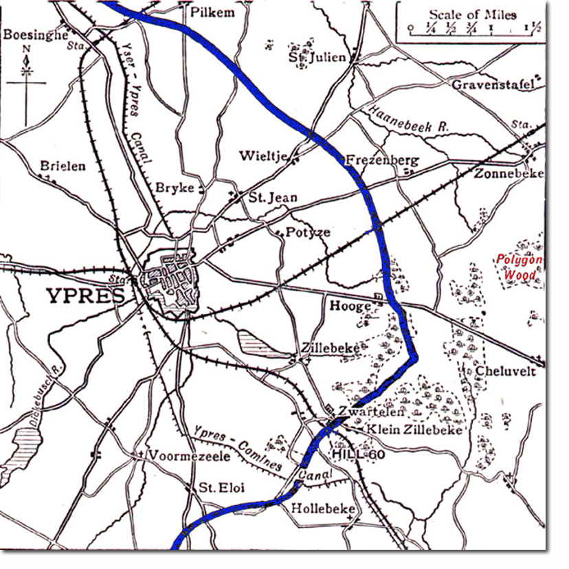
| The first position occupied by the Patricias was Polygon Wood, on the right of the map. They were moved due west to the British front line indicated in blue, and took up position near Bellewaerde Lake (not shown) north of Hooge. The wooded area in the 'point' of the blue line is Sanctuary Wood. The Patricias' former area of operation, St Eloi, can be seen near the bottom of the map, due south of Ypres. |
Armed Forces | Art and Culture | Articles | Biographies | Colonies | Discussion | Glossary | Home | Library | Links | Map Room | Sources and Media | Science and Technology | Search | Student Zone | Timelines | TV & Film | Wargames
