|
|


|
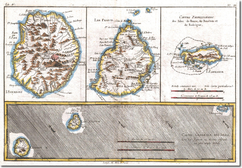
| An 18th century map showing the three islands known as the Mascarene Islands. The Ile de Bourbon (now called Réunion), the Ile de France (Mauritius) and the Ile de Rodrigue (Rodriguez). Rodriguez is about 350 miles east of Mauritius, and Bourbon is 340 miles east of Madagascar. Bourbon and Mauritius are about 175 miles apart. An active volcano is illustrated on the map of Bourbon. The Bay of St Paul is on the northwest of Bourbon, between Point Dauphine (or Galet) where the troops were landed, and Point de Bourgoyne, where the port of St Paul was situated. St Denis is on the northern tip of the island. An enlarged detail of the map of Bourbon is shown below. |
Armed Forces | Art and Culture | Articles | Biographies | Colonies | Discussion | Glossary | Home | Library | Links | Map Room | Sources and Media | Science and Technology | Search | Student Zone | Timelines | TV & Film | Wargames