|
|


|
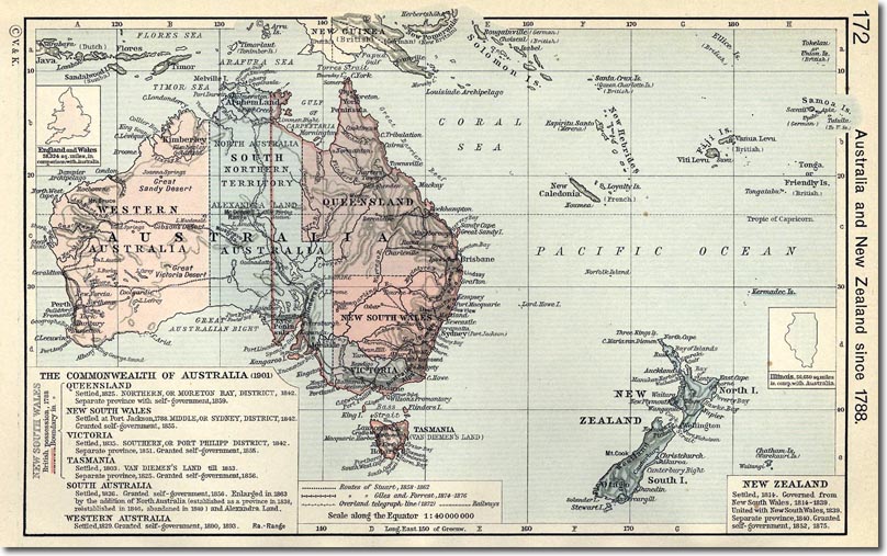
| This is a map from a 1911 textbook and historical atlas by William R. Shepherd. It shows the constitutional development of Australia and New Zealand and the surrounding Islands of the Western Pacific. It shows the German colonies which were mostly hoovered up by British and Imperial forces in 1914 at the outset of World War One. |
Armed Forces | Art and Culture | Articles | Biographies | Colonies | Discussion | Glossary | Home | Library | Links | Map Room | Sources and Media | Science and Technology | Search | Student Zone | Timelines | TV & Film | Wargames