|
|


|
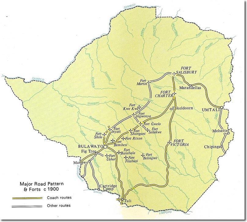
| This map shows the 'limited' extent of communications routes in the early stages of the development of the colony. It shows that the transport links relied largely on those coming from the existing colonies to the South. The prevalance of forts also demonstrates the frontier status of this colony - remembering that two substantial rebellions had occurred in the 1890s. This image was kindly donated by Richard Allport. |
Armed Forces | Art and Culture | Articles | Biographies | Colonies | Discussion | Glossary | Home | Library | Links | Map Room | Sources and Media | Science and Technology | Search | Student Zone | Timelines | TV & Film | Wargames