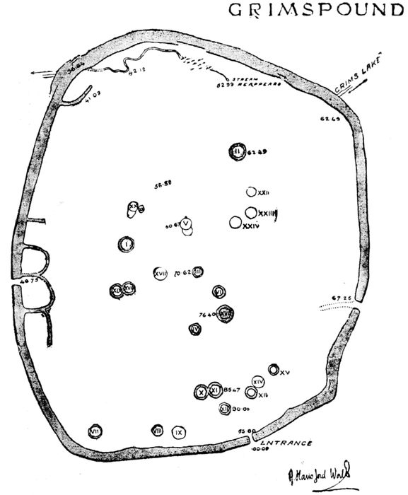
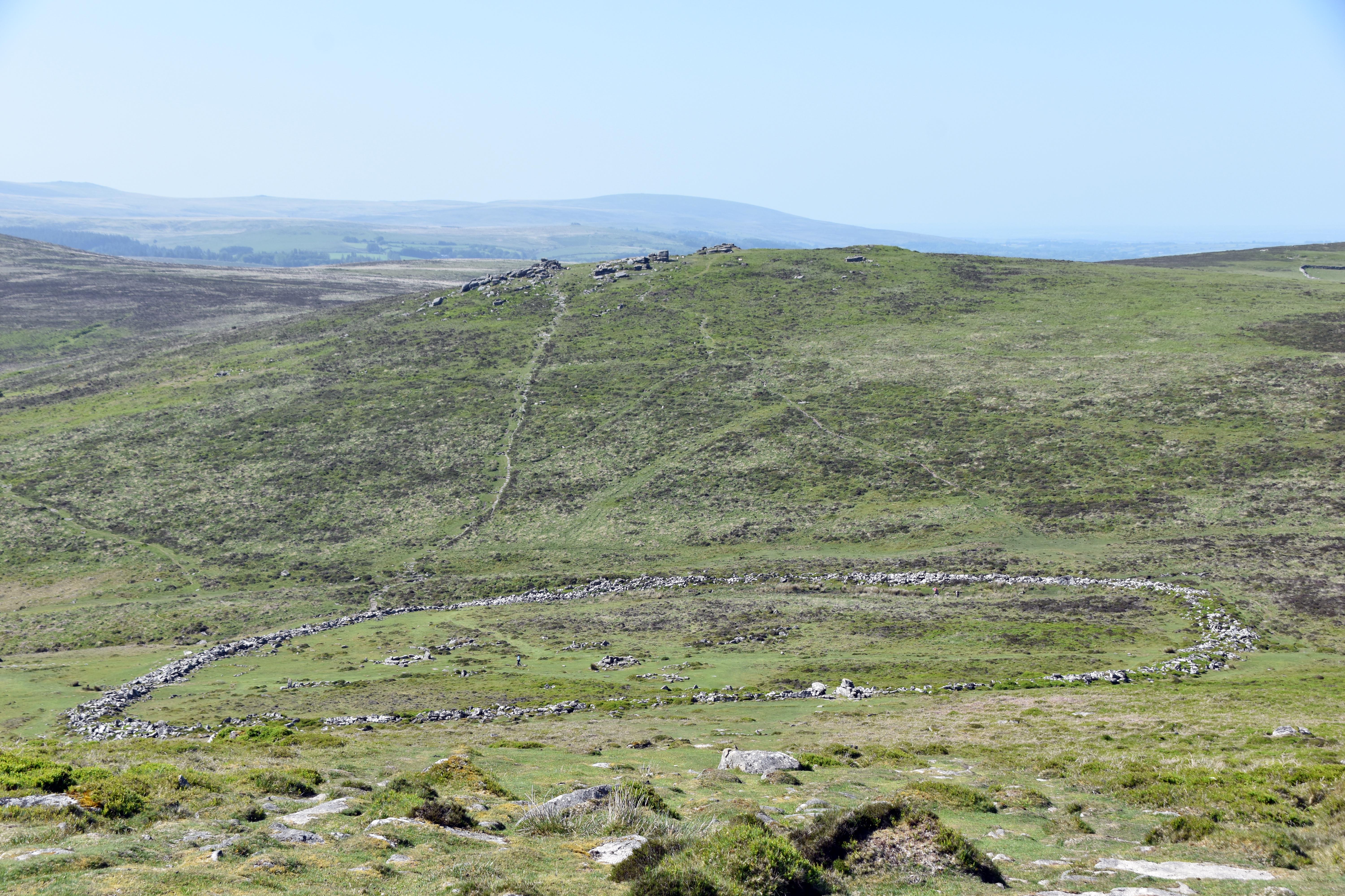
Grimspound is a Late Bronze Age enclosed settlement with an associated field system, situated below the saddle between Hameldown Tor and Hookney Tor and overlooking the valley of the West Webburn River. The enclosure survives as a stone and earth wall between 2.5 and 3.5 metres wide and up to 1.25 metres high, surrounding an internal ovoid area of about 1.45 hectares. Within this area are at least twenty‑four stone hut circles, together with lynchets and rubble banks.
The original entrance cuts through the south‑eastern side of the enclosure wall. It survives as a 2‑metre‑wide gap flanked by walling up to 2 metres high. The northern face of the entrance passage is formed by two large edge‑set slabs with a boulder balanced above and coursed walling to either side. The southern face consists of horizontally laid slabs. The entrance was reconstructed after the Dartmoor Exploration Committee’s excavation in 1894. The ground within the passage and the area immediately outside is roughly paved. The 1894 excavation recorded three steps in the paving leading down to the lower interior. Two further breaks in the enclosure wall are not original and relate to the bridle path that crosses the site.
The enclosure appears to have been positioned to make use of the Grim’s Lake stream, which flows through the northern part of the interior. A purpose‑built culvert allowed the stream to pass through the wall. The settlement’s location also provides access to grazing on the slopes below.
Within the enclosure, the twenty‑four hut circles survive as banks of stone and earth surrounding circular or oval interiors. These may be later in date than the enclosure itself. Twenty huts are circular, with internal diameters between 2 and 5 metres, averaging 3.17 metres. The remaining huts are oval, measuring between 4.9 and 2.8 metres long by 4.2 and 2 metres wide. Wall heights vary between 0.2 and 0.9 metres, with an average of 0.57 metres. Sixteen huts were partly excavated in 1894, revealing porches, doorways, raised benches, paved floors, hearths, cooking holes, charcoal, anvil stones, pottery, flint flakes, flint scrapers and cooking stones. The huts were partly restored using debris removed during the excavation.
Low rubble banks against the western side of the enclosure define at least four small internal paddocks or garden plots. These postdate the enclosure wall but are likely to be contemporary with the settlement. A small number of lynchets also survive and may represent stock‑control boundaries.
Immediately south‑east of the enclosure are at least nine further hut circles, together with lengths of field boundary wall and areas cleared of surface stone. These huts are linked by rubble banks forming part of a field system. Eight are circular, with internal diameters between 3.2 and 5.3 metres, averaging 4.16 metres. The remaining hut is oval, measuring 3 metres by 2.5 metres, with a wall 1.3 metres wide and up to 0.5 metres high. One hut has a visible doorway and two are conjoined. The boundary banks average 1.2 metres wide and 0.4 metres high and form at least four partly enclosed fields. Additional cleared areas indicate attempts at cultivation.
Two small post‑medieval caches provide evidence for later reuse of the site. The first is built against the inner face of the south‑western circuit of the enclosure wall and survives as a three‑sided drystone structure 1.5 metres wide and 0.4 metres high, using the enclosure wall as its fourth side. Its interior measures 1.3 by 1.2 metres. The second cache is built within the eastern length of the enclosure wall and survives as an oval hollow 1.4 metres long, 1.1 metres wide and 1.3 metres deep, created by removing stones from the wall core. Their size suggests they were used for storage rather than as shelters.
Grimspound is generally dated to the Late Bronze Age, between about 1450 and 700 BC. The settlement fits within a wider pattern of upland occupation that declined after around 1200 BC as soils deteriorated and the climate became wetter. The name Grimspound was first recorded by the Reverend Polwhele in 1797 and may derive from the Anglo‑Saxon god Grim, also known as Woden or Odin.
The link below comes from Sabine Baring-Gould's A Book of Dartmoor