

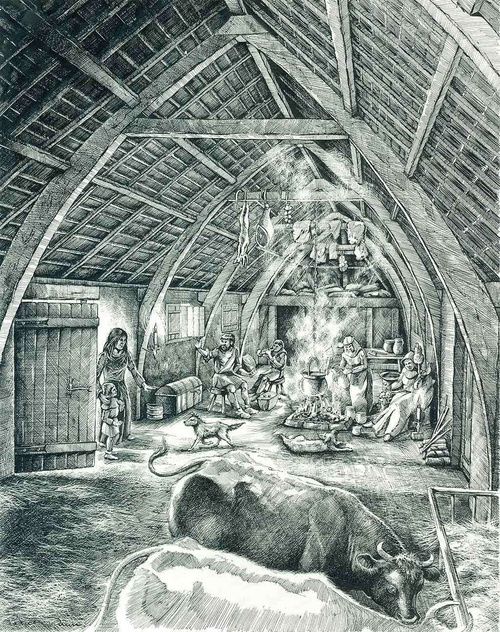
Hundatora is a deserted medieval settlement situated on the eastern slope below Hound Tor. The site preserves the ground plans of longhouses, outbuildings and associated enclosures belonging to a small upland farming community. Archaeological evidence places its occupation between the thirteenth and fifteenth centuries, with abandonment occurring before the sixteenth century. Its survival is due to the absence of later agricultural improvement and the stability of the surrounding moorland landscape.
The settlement comprises a linear group of rectangular longhouses aligned along a natural terrace. Each longhouse follows the standard Dartmoor medieval form: a single elongated structure divided into a domestic upper end and a byre or shippon at the lower end, with opposed entrances forming a central cross‑passage. The walls, built of granite rubble, survive as low banks defining the internal layout. Adjacent smaller buildings are interpreted as barns, storage structures or ancillary byres.
The field system surrounding Hundatora includes lynchets, boundary walls and traces of strip cultivation. These features indicate a mixed farming economy combining limited arable production with stock grazing. The proximity of Becka Brook provided water, while the slopes below Hound Tor offered pasture. The settlement pattern corresponds to other upland farmsteads established during the medieval expansion onto Dartmoor’s higher ground.
Documentary references to Hundatora are sparse. The name appears in medieval forms consistent with a small agricultural holding rather than a nucleated village. The physical evidence, however, is clear: the settlement was permanently occupied for several generations before being abandoned. The reasons align with wider regional contraction in upland settlement during the later Middle Ages. Contributing factors likely included climatic deterioration, reduced yields, soil exhaustion and changes in land management by manorial authorities.
The site was first recorded by antiquarians in the nineteenth century and later surveyed in detail by archaeologists in the twentieth century. Plans produced during these surveys show the arrangement of longhouses, outbuildings and enclosures with considerable clarity. The absence of later rebuilding or agricultural disturbance has left the medieval layout intact, making Hundatora one of the best‑preserved deserted settlements on Dartmoor.
Hundatora forms part of a wider archaeological landscape around Hound Tor. Nearby features include prehistoric enclosures, reaves, cairns and later industrial remains. The medieval village represents a distinct phase in this long sequence of occupation. Its relationship to the surrounding field systems and to the topography of the slope below Hound Tor provides valuable evidence for medieval land use and settlement organisation in upland Devon.
Image courtesy of Historic England. Historic England: Hound Tor Deserted Medieval Village
Map of Hound Tor Medieval Village here

