Ide lies less than a mile to the south‑west of Exeter, yet for most of its history it has remained a distinct settlement, shaped by the ridge and valleys that separate it from the city. The earliest known activity on the site is Roman. On the hilltop above the village, at SX8888, are the remains of a Roman signal station, part of a wider military communication system that once linked forts, camps and towns across the region. These stations were rectangular towers of timber or stone set within ditched or palisaded enclosures, used for observation and for signalling by fire or smoke. The Ide example survives mainly as buried features: an outer rectangular enclosure with rounded corners, an inner square ditched enclosure, a causeway with large post‑holes marking the likely tower position, and a series of pits and circular features including one containing burnt material. Although reduced to slight earthworks, the archaeological evidence suggests a well‑preserved site of national importance.
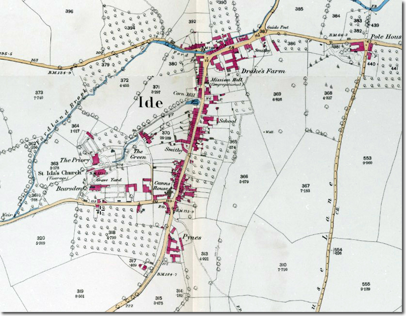
By the medieval period Ide had developed into an agricultural community. Its long, slightly curving Fore Street preserves the medieval plan, with narrow plots running back from the road. A ford still crosses the Fordland Brook at College Lane, marking one of the traditional approaches to the village. The parish church, dedicated to the German Saint Ida of Herzfeld, retains its fifteenth‑century volcanic‑trap tower, the principal medieval survival. The remainder of the building was rebuilt in 1833–34 after a period of decline, with further early twentieth‑century fittings by Herbert Read of Exeter. The churchyard contains several notable memorials, including those to the Studholme family of Perridge and to parishioners who died in the First World War.
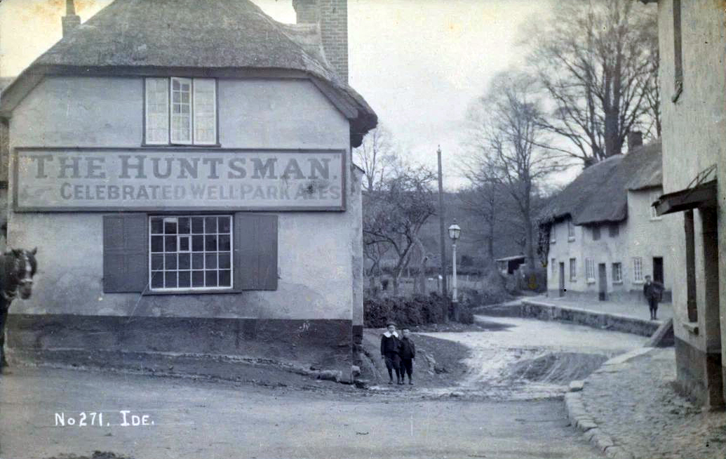
A nineteenth‑century description observed that “the majority of Ide’s residents lived in the village itself in a long street where many picturesque cottages, with thatched roofs and olde‑worlde gardens give no hint of the nearness of Exeter, from which indeed they are entirely hidden by surrounding hills.” For much of this period most villagers worked locally, many in the woollen or serge industry that formed an important part of the rural economy around Exeter. Nonconformity also had a presence: the former Congregational Church, built in local stone, served a modest but steady congregation and remains a prominent building on the approach to the village centre.
At the turn of the twentieth century Ide was still a largely self‑contained community. There were six shops — two bakers, two butchers and two general stores — as well as a working mill, a brew house, a wheelwright, a blacksmith, a primary school, a congregational chapel, a policeman, a midwife and two doctors. Most of the population worked on the six farms or in service in the larger houses such as Pole House and Ide House. Despite the agrarian and industrial changes of the nineteenth and twentieth centuries, population numbers did not fluctuate greatly, owing to the proximity of Exeter for employment.
The village was served by Ide Halt on the GWR Teign Valley Line, opened in 1903 and closed to passengers in 1958. The site was later redeveloped as St Ida’s Close and no trace of the station now remains. The construction of the A30 dual carriageway, controversial at the time, placed a physical barrier between Ide and the expanding suburbs of Exeter. In practice it helped the village retain an independent identity, though the parish boundary extends across the road and includes several notable buildings on the Exeter side, including Ide House and the Twisted Oak pub.
Today Ide remains one of the closest true villages to Exeter. Its mixture of Roman archaeology, medieval street pattern, Georgian and Victorian houses, and twentieth‑century layers offers a clear view of how a small Devon parish developed on the edge of a growing city while maintaining its own character.