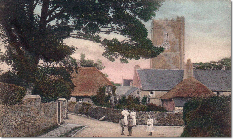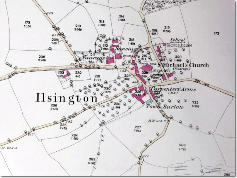
Ilsington is a long‑established Dartmoor parish on the eastern edge of the moor, recorded as early as the twelfth century and centred on St Michael’s Church. The village developed around the church, the manor and the surrounding farms, with the parish boundaries extending up onto Haytor Down and across to the older Saxon land divisions that once defined the area. Its position between the moor and the lowlands gave it mixed character: upland grazing, woodland, and access to the growing market towns of Bovey Tracey and Newton Abbot.
The medieval parish was shaped by agriculture and by the manorial estates that controlled much of the land. Ilsington Manor and Natsworthy Manor both held territory on the moor, and their boundaries were later marked by the nineteenth‑century stones erected by the Duke of Somerset. The village itself remained small, with scattered farmsteads, cottages and lanes leading up towards Haytor and down towards the Teign valley. The church, with its thirteenth‑ and fourteenth‑century core, was the main architectural focus and still dominates the centre of the settlement.
From the eighteenth century onwards the parish was influenced by the wider industrial activity of the region. The Templer family’s developments at Stover, the Stover Canal and the Haytor Granite Tramway all lay within reach of the parish, and many local men worked in the quarries, clay pits and associated trades. The granite hauled down from Haytor passed close to the parish boundary before reaching the canal basin at Ventiford. Although Ilsington itself did not industrialise, it was tied into the transport and labour networks that supported these industries.
The nineteenth century saw modest growth, with new cottages, smallholdings and the usual parish institutions of the period. The church was restored in the mid‑Victorian years, and several of the monuments inside the building record families connected with the wider area, including those from Ingsdon and the surrounding farms. The parish remained largely agricultural, with sheep, cattle and ponies grazing the moorland above the village. The lanes, boundary stones and field systems visible today reflect this long continuity.
In the twentieth century the parish changed more slowly than many others. Farming continued, the moor remained central to local life, and the village expanded only gradually. The war memorials in the lychgate record the men of the parish who died in the two World Wars. Later in the century, improved roads and the growth of nearby towns brought more visitors to the area, but the village retained its scale and character. The church, the manor sites, the farms and the moorland tracks still define the settlement much as they did in earlier centuries.
Ilsington today remains a working Dartmoor parish with a clear historical footprint: medieval church, manorial boundaries, nineteenth‑century stones on the down, and a landscape shaped by farming and by the industries that once operated nearby. Its position below Haytor gives it a close connection with the moor, and many of the routes used now follow the same lines taken by parishioners, farmers and quarrymen for generations.