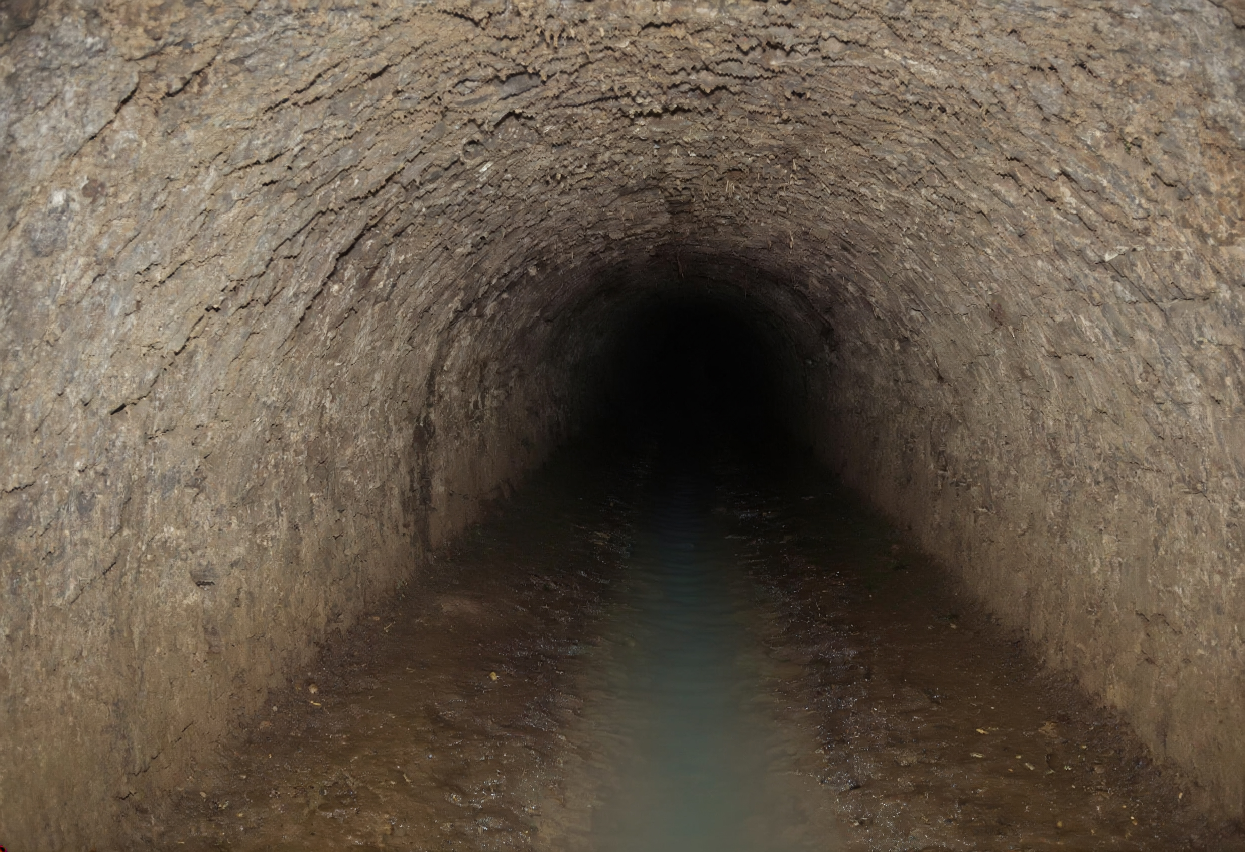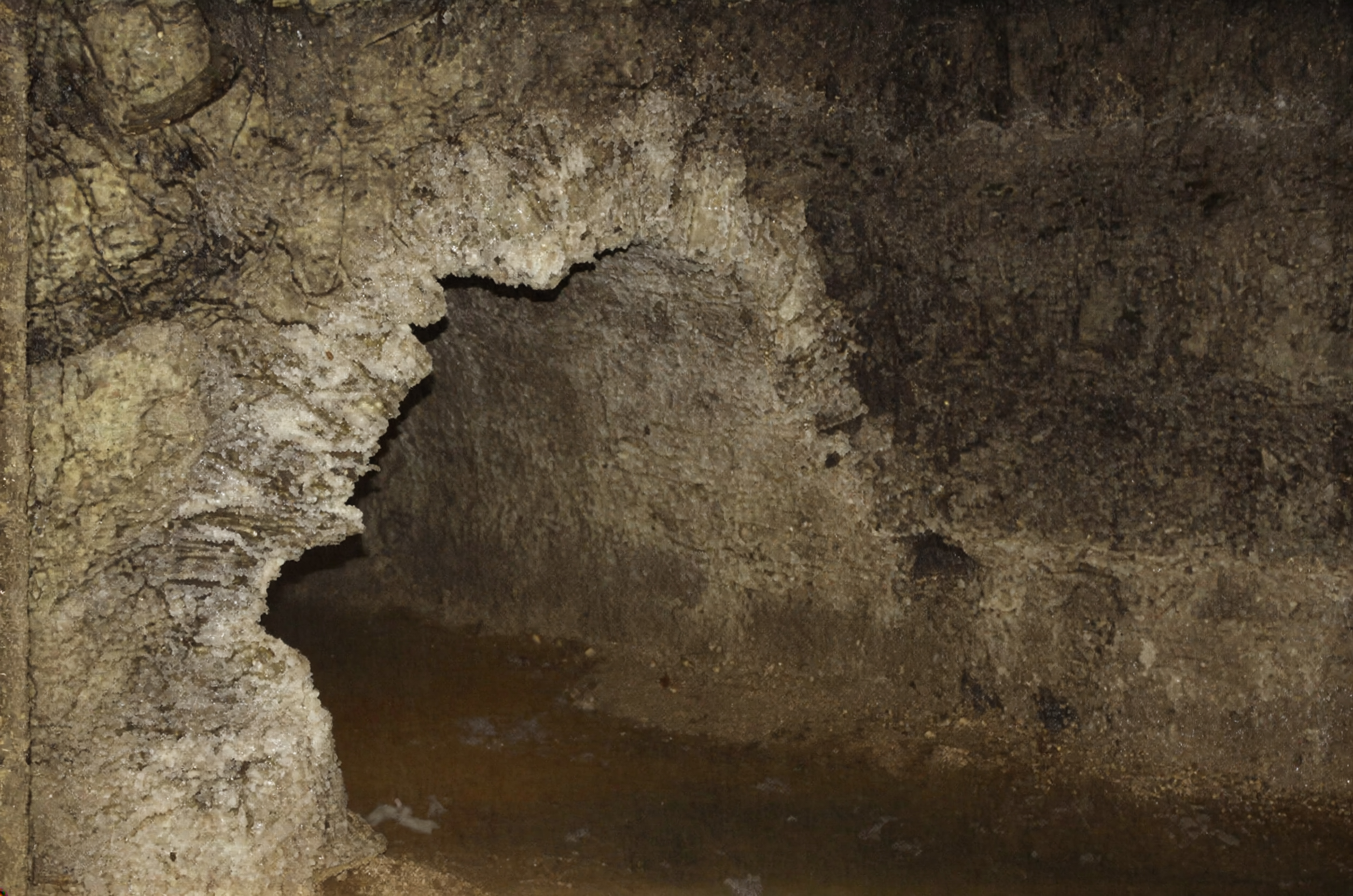
Houndiscombe Road follows the course of Plymouth Leat between North Hill and Mutley Plain. Although nothing can now be seen from the road, the leat still runs beneath part of it. This section was originally an open watercourse carrying water towards Drake’s Place and the centre of Plymouth.
From Drake’s Place the leat passed through what is now the University of Plymouth campus before reaching the junction of Houndiscombe Road and North Road East. It emerged close to the row of houses on the north-eastern side of the junction and then followed the line of Houndiscombe Road. Near St Lawrence Road it departed briefly from the present road because the channel had to follow the contour rather than the most direct route.
The course of the leat was determined by gravity. There were no pumps in the original system, so the channel required a continuous shallow fall from the River Meavy to Plymouth. Even a modest rise in the ground had to be avoided. This explains the numerous curves and diversions along its route and why its course sometimes appears inefficient when compared with the streets built later.
When the leat was constructed at the end of the sixteenth century, Houndiscombe remained outside the densely built part of Plymouth. The water ran through an open ditch between earthen banks. This was adequate in a rural setting, but the arrangement became increasingly unsuitable as housing spread north from Plymouth during the nineteenth century.
Open leats were vulnerable to pollution. Surface water, domestic refuse and waste from animals could enter the channel, whilst damaged banks allowed water to escape. The leat also presented a danger to children and obstructed the development of roads and building plots. These problems became more serious as Houndiscombe changed from open ground into an urban district.
In 1864 the civil engineer Thomas Hawksley reported on Plymouth’s water supply. He criticised the condition of the leat, noting its leakage, irregular dimensions, excessive meandering and exposure to contamination. On Dartmoor its banks could be damaged by livestock. Within the urban area the open channel was increasingly difficult to protect from pollution.
Hawksley recommended that the leat should be given a more regular width and depth, with a concrete bed and granite-lined sides where necessary. He also advised covering the channel through built-up districts. By this time Plymouth could obtain drinking water from the Hartley Reservoir, supplied through pipes from Crownhill. The section of the old leat below Crownhill no longer needed to remain the town’s principal source of domestic water.
After Hartley assumed that role, water in the lower leat continued to serve commercial users and could be used for firefighting and flushing drains. This reduced the consequences of enclosing the leat beneath streets, since direct access to the water was no longer required along its urban course.
The Houndiscombe section was covered and the road was constructed above it. The route provided a comparatively level approach to Plymouth, avoiding the steeper climb over North Hill. A tramway was later laid along the road, and steam trams were experimentally operated on the route. The road therefore inherited its alignment and gradient from the watercourse beneath it.
Opposite Allendale Road, a gap between the buildings marks the position of an overflow. When the water level in the leat became too high, surplus water could be discharged towards the Pennycomequick stream and into the Stonehouse Leat. This prevented excess water from continuing towards the reservoirs and the lower parts of Plymouth.
At the northern end of Houndiscombe Road, close to Mutley Plain, a Plymouth Leat boundary marker survives in its original position. These markers identified the leat as the property of Plymouth Corporation and warned against interfering with the channel, taking water without authority or polluting the supply.
Later roadworks have exposed parts of the old channel beneath Houndiscombe Road. The leat lies well below the modern road surface because the surrounding ground level was altered as the road and adjoining properties were developed. Its survival beneath the street explains why Houndiscombe Road follows a route established for the movement of water rather than one originally planned for vehicles.