

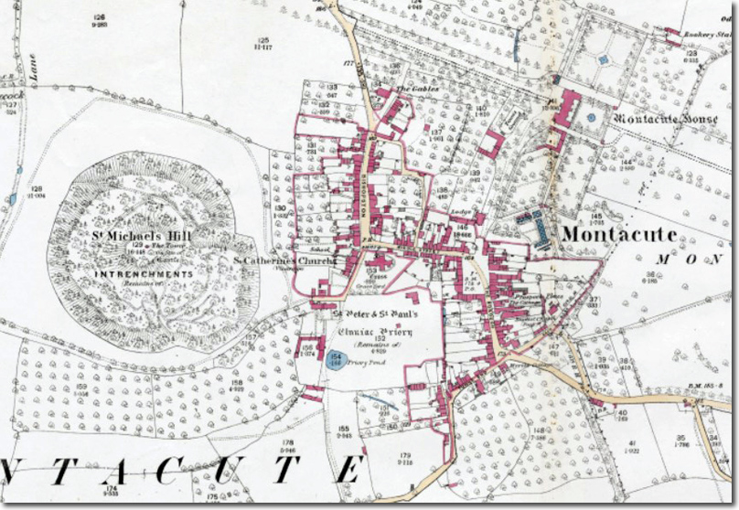
Montacute occupies a position east of Ham Hill, on uneven Yeovil Sands terrain shaped by prehistoric and Roman activity on the hilltop. Although no prehistoric settlement is known within the modern village, Ham Hill’s long sequence of occupation — mesolithic to Roman — formed the dominant early presence in the landscape. The Roman fort in the north‑east corner of the Iron Age defences indicates continued strategic use of the hill, with the later village developing nearby.
The earliest reference to the settlement appears in a seventh‑century charter recording Baldred’s gift of sixteen hides at Logworesbeorh to Glastonbury Abbey. By the ninth century the place was known as Bishopston, probably reflecting the influence of Tunbeorht, abbot of Glastonbury and bishop of Winchester. The main north–south route through the village still bears the name Bishopston, preserving the line of the early settlement. A chapel dedicated to St Peter likely existed by the mid‑ninth century and later became the priory church.
During the reign of Cnut the manor was held by Tofig, and tradition associates this period with the discovery of a holy cross on St Michael’s Hill. At Domesday the estate passed to Robert of Mortain, who constructed a motte‑and‑bailey castle on the hill. The new settlement took the name Mons Acutus from the conical form of the hill. The castle was besieged in 1068 but declined thereafter, though its earthworks remain prominent. A chapel dedicated to St Michael formed part of the complex, its masonry partly reused in the eighteenth‑century tower.
In c.1102 the Mortain family founded a Cluniac priory to the south of the village, endowing it with the castle, borough, market, mill, manor and vineyards. The priory precinct, fishpond and dovecote survive as earthworks and standing structures. The priory’s presence shaped the medieval town: burgage plots were laid out along Bishopston, and a new borough was created in the late twelfth or early thirteenth century to increase revenue. A planned market square and regular plots are recorded on the 1782 estate map.
Montacute’s medieval prosperity peaked in the fourteenth century, when it paid the ninth‑highest tax in Somerset. The town’s fortunes declined after the Dissolution in 1539, when the priory estate fragmented. Over the following decades the Phelips family emerged as the dominant landowners. Edward Phelips purchased land at Whettles in 1595 and built Montacute House, establishing the great house and its formal courts and gardens north of the medieval borough.
Post‑medieval Montacute retained its earlier street pattern. The London–Exeter coach road brought traffic through the village, supporting inns and small industries. Wiseman’s bell foundry operated from the late sixteenth to mid‑seventeenth century, and cloth and leather trades were present. By the nineteenth century the settlement was largely agricultural, though the arrival of the railway in 1882 connected Montacute with Yeovil and Taunton.
Twentieth‑century changes were limited. A bypass diverted traffic away from the village, and Montacute House and its park passed to the National Trust. The village retains its medieval framework: Bishopston, Middle Street and South Street follow their established lines; the priory precinct survives as earthworks; and the castle mound remains a dominant feature.

