

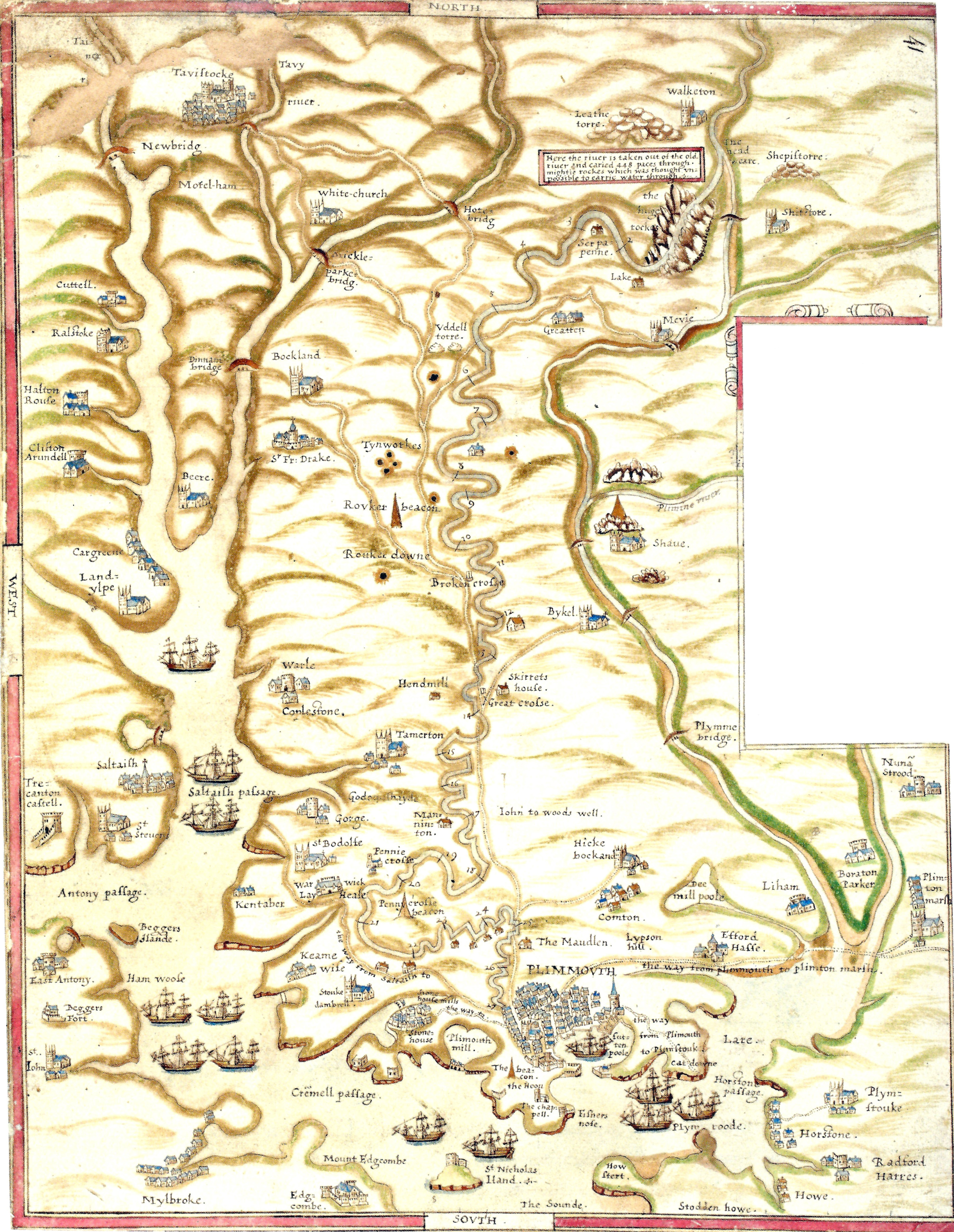
The Spry map of 1591 is the earliest known cartographic record of Drake’s Leat and the first attempt to show the complete route from the Meavy watershed to Plymouth. Drawn only months after the leat was cut, it fixes the line of the channel at a time when the work was still new and unaltered by later diversions and repairs. The map is not decorative; it is a working document produced to demonstrate that the leat followed the authorised course and delivered water to the town as agreed.
On the moor the map shows the intake on the River Meavy and the initial section of the leat running along the contour, keeping a steady fall without losing height unnecessarily. This early survey confirms that the builders understood how to maintain a continuous gradient over long distances, using experience from mining and tin‑working leats. The line then passes south and east, crossing manors and commons, and the map records key farms, boundaries and landmarks needed for legal and practical reference. These names and features anchor the leat in the existing landscape and show where compensation and rights of way were required.
Closer to Plymouth the Spry map marks the approach to the town and the point where the leat was diverted towards Drake’s mill. It identifies the main entry to the urban system and the branch that later became Mill Lane’s industrial supply. The map’s value lies in its precision: it shows the leat before later reservoirs, culverts and urban changes obscured the original line. Modern reconstructions of the route rely heavily on this document to confirm where the channel ran and how it related to field systems, tracks and early property boundaries.
For walkers and researchers, the Spry map provides a baseline against which later tithe maps, Ordnance Survey sheets and Corporation plans can be compared. It explains why the leat follows particular contours, why it passes certain farms and avoids others, and how the original engineers balanced fall, distance and legal constraints. Without this 1591 survey, much of the early history of Drake’s Leat would rest on scattered written references; with it, the first route from Meavy to Plymouth can be traced on the ground with confidence.

