

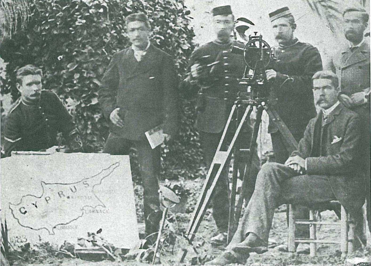
In 1878 a young officer of the Royal Engineers, Herbert Kitchener, was sent to Cyprus as part of the British survey team tasked with mapping the island. Seated among his colleagues with theodolite and charts, he was not yet the figure who would later dominate imperial campaigns in Sudan and South Africa, but an able and conscientious engineer whose precision and diligence were already evident. His work on the Cyprus survey established his reputation for methodical accuracy and attention to detail, qualities that would mark his entire career.
The survey of Cyprus was no routine exercise. Britain had just assumed control of the island under the terms of the Cyprus Convention, an agreement signed with the Ottoman Empire in June 1878. In return for Britain’s promise to defend Ottoman territories in Asia against Russian expansion, the Sultan granted Britain the right to occupy and administer Cyprus. The arrangement was part of the wider diplomatic settlement following the Russo‑Turkish War and the Congress of Berlin, where the balance of power in the eastern Mediterranean was being recalibrated.
For the British government, Cyprus offered a strategic base close to the Suez Canal, the vital artery to India. Before the island could be effectively administered or garrisoned, however, it had to be properly mapped. Much of the terrain was poorly charted, and reliable surveys were essential for taxation, land tenure, and military planning. The task fell to the Royal Engineers, and among them Kitchener distinguished himself by the thoroughness of his work. He produced detailed maps that remained in use for decades, combining field measurements with careful draughtsmanship.
Kitchener’s time in Cyprus was formative. He learned Arabic and Turkish, immersed himself in the practicalities of administration, and gained experience in the kind of patient, technical labour that underpinned imperial governance. His maps of the island were not only tools for soldiers and officials but also symbols of Britain’s new authority, inscribing imperial order onto a landscape that had only recently changed hands.
The British occupation of Cyprus in 1878 thus had both a diplomatic and a practical dimension. Diplomatically, it signalled Britain’s determination to check Russian influence in the eastern Mediterranean. Practically, it required the work of engineers like Kitchener, whose surveys transformed the island from a vague possession into a governable territory. The image of him seated beside his colleagues, overseeing the great map of Cyprus spread on the ground, captures the moment when his reputation as a meticulous soldier‑engineer was first secured, and when Cyprus itself entered a new chapter under British administration.

