

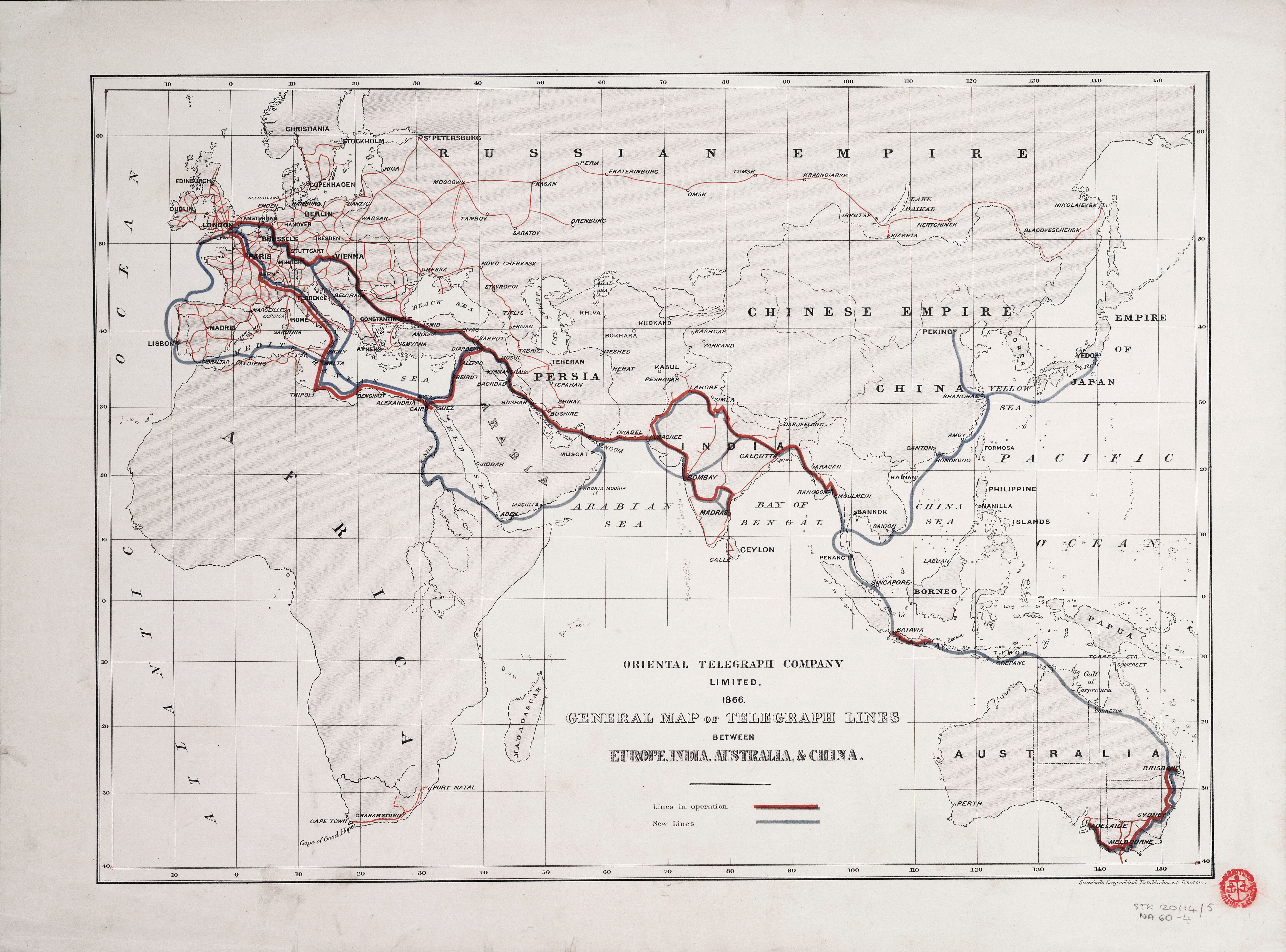
The 1866 map of telegraph lines between Europe, India, Australia, and China illustrates the ambition of mid‑nineteenth‑century communications: to bind continents together by wire. Among its most critical stretches was the Persian section, a land corridor that linked the submarine cables of the Persian Gulf with the overland routes through Turkey and Russia. Without this connection, the dream of a continuous telegraph from London to Bombay would have remained incomplete.
The Persian section was both technically demanding and politically delicate. Persia’s government was wary of foreign intrusion, and the terrain presented formidable obstacles. Negotiations in Tehran required tact as much as engineering skill. It was here that John Underwood Bateman‑Champain, a young officer of the Bengal Engineers, made his mark.
Bateman‑Champain had already distinguished himself in India during the Rebellion of 1857, where he served with the Bengal sappers at Delhi and Lucknow. In 1862 he was selected, alongside Major Patrick Stewart, to undertake the Persian telegraph mission. The task was to survey, negotiate, and construct a line that would carry messages across 1,250 miles of mountains, deserts, and tribal territories.
Arriving in Tehran, Bateman‑Champain faced officials who insisted that only one English officer could supervise the work. He appeared instead with a full team of officers and men, a gesture that might have provoked confrontation but was softened by his courtesy and persistence. The Shah, impressed by his manner, eventually sanctioned the project.
The work was arduous. Insulators were used for target practice by tribesmen, and whole sections had to be rebuilt. Bateman‑Champain’s diplomacy secured the Shah’s intervention, dispatching troops to enforce order along the line. By 1865 the Persian section was complete, and messages that had once taken months could now pass from London to India in hours.
Bateman‑Champain’s responsibilities did not end there. He travelled to Turkey to improve the Baghdad section, and to St Petersburg to negotiate with Russian officials for a dedicated wire through their territory. His relations with General Alexander von Lüders, director of Russian telegraphs, ensured the continuity of the system. In 1870 he succeeded Sir Frederic Goldsmid as chief director of the Indo‑European Telegraph Department, overseeing the entire route.
The Persian section was the keystone of the Indo‑European Telegraph. It bridged the gap between Europe and the Gulf, making possible the first reliable, government‑controlled line of communication between Britain and India. Bateman‑Champain’s role was central: engineer, negotiator, and administrator, he embodied the hybrid skills required to turn a line on a map into a functioning artery of empire.
By the time of his death in 1887, the Indo‑European Telegraph was firmly established, its wires stretching across continents. The Persian section, once the most uncertain link, had become its most vital. Bateman‑Champain’s work ensured that the red and blue lines traced on the 1866 map were not merely cartographic symbols but living channels of communication, carrying the words of governments, merchants, and families across half the world.

